La Palma: volcanic landscapes and trails that tell the story of the Earth
A volcanic trek connecting historic craters, lava landscapes, and Canary-Island pine forests
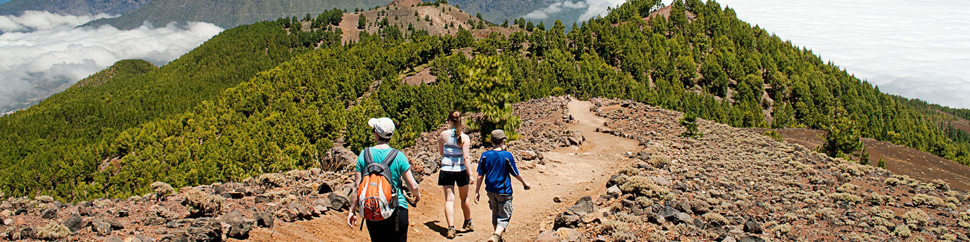
Through its Volcanic Route, La Palma unveils a unique journey allowing visitors to walk among craters, solidified lava fields, and Canary-Island pine forests, set within a landscape where nature tells the story of centuries of volcanic eruptions. Boasting landscapes that astonish at every turn and a heritage deeply rooted in volcanism, this trekking experience stands out as one of the unique highlights of the Canary Islands, blending sport, science, and culture into a trail that captures the very essence of the island. The Volcano Route is one of La Palma’s greatest treasures—a trail that stretches across the island’s south and has become a unique experience for those seeking an intimate connection with the raw power of geology. Located within the Cumbre Vieja Nature Park, this trek extends from the Pilar Refuge to the town of Fuencaliente, crossing landscapes defined by historic lava flows, volcanic cones, and resilient pine forests rooted in the lava fields. Stretching nearly 14 miles with an elevation gain of around 4,000 feet, this route demands physical fitness and proper equipment. The terrain combines sections of trail, forest track, and asphalt, offering breathtaking views across both sides of the island. All this effort is richly rewarded with a genuine natural and cultural showcase: iconic volcanoes, endemic species such as the graja or red-billed chough—La Palma’s symbolic bird—and unique geological formations.

The route links some of the island’s most remarkable volcanic landmarks. From the Birigoyo viewpoint, you can take in the sweeping Aridane Valley, with views reaching as far as the Cumbre Nueva ridge and the Bejenado volcano. Further along, the route ventures into historic sites such as Hoyo Negro and Duraznero, key sites in the 1949 eruption, and into the realm of the Martín volcano, whose 17th-century eruption extended the land into the sea. Finally, the trek concludes at Los Canarios, a wine-producing village shaped by the San Antonio and Teneguía eruptions. Throughout the journey, hikers will observe the vegetation gradually recolonizing these young volcanic soils, alternating between pine forests and summit shrublands. This contrast reflects the ongoing dialogue between life and fire, a coexistence that has shaped La Palma’s unique identity. Local heritage can also be found in details like the ancient wooden stakes that have guided travelers along this very path for centuries. What’s more, some companies offer guided hikes to the crater of the Tajogaite volcano, bringing visitors close to the site of the 2021 eruption—the birthplace of Spain’s youngest lands. Spanning roughly 4.5 miles with moderate difficulty, this guided experience leads you through ash and lapilli, offering a chance to witness both the damage to vegetation and the landscape’s remarkable power of regeneration. Location La Palma is one of the westernmost islands of the Canary Islands, part of the province of Santa Cruz de Tenerife, Spain. It can be accessed via La Palma Airport (SPC), located in Breña Baja, which offers both domestic and international flights, as well as the Port of Santa Cruz de La Palma, which connects the island by sea to Tenerife and other islands.